
Domenichini Giuliano/Shutterstock
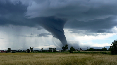
Both hurricanes and tornadoes work in very different ways, which is why one is usually far more destructive than the other. A hurricane is a tropical cyclone, a rotating storm system that spins up over warm ocean water and can sprawl across hundreds of miles, lasting for days. Meanwhile, a tornado is a much skinnier column of violently spinning air that lasts between a few seconds and an hour, so it’s usually far less damaging. That’s an interesting detail considering tornadoes are faster in terms of wind speed. In fact, the fastest wind anyone has ever recorded on this planet came from one of those. It was back in May of 1999, when a research radar parked near a tornado in the heart of Tornado Alley, outside Oklahoma City, clocked air moving at 301 miles per hour just above the ground.
Hurricanes are slower, with the strongest ones — at least in the Atlantic – topping out at roughly 190mph of sustained wind speeds. Sustained here refers to the pace the storm holds for a full minute.
We know these speeds thanks to various instruments, the most common being Doppler radar. This is a dish that works by firing short pulses of radio waves at a storm, which then bounce off raindrops and airborne debris before heading back. Depending on how they’re moving, the signal arrives at a slightly different frequency, which the computer then records. Sometimes, Doppler radars are mounted on wheels – typically on the flatbed of a truck — which is actually how the above record was measured.
Doppler radar isn’t the only tool in use here
Nicholas J Klein/Shutterstock
However, the Doppler radar isn’t always the only instrument, since storms move around and change rapidly. They are highly complex, too, requiring multiple readings across time or space for greater accuracy.
For hurricanes, another commonly used tool is the standard weather station, which uses an anemometer — those spinning cups that measure wind speed by logging averages over a full minute. The problem is that these only work well when they stick around for long enough.
Hurricane speeds are also measured using satellites and planes when greater accuracy is required. A great example is NOAA’s Hurricane Hunters planes, which fly straight through the eyewall of these storms. They then drop these tube-shaped instruments, called dropsondes, that radio back wind and pressure data as they fall toward the water. These were used with Hurricane Melissa before it hit Jamaica in 2025, during which one of them recorded a 252mph gust.
Meanwhile, tornadoes are different because they cover far less area and die out quickly. The odds of one hitting a station simply aren’t great, which is why a lot of the gear used for reporting speeds has to be directly in its path.
Catching a tornado’s wind speeds accurately is mostly luck
For tornadoes, a distant dish can only flag the rotation inside a storm, since it fires beams from far away. To read the wind itself, it has to get up close and personal. This is why mobile units are typically used, though it’s still a game of luck since these units have to be at the right place at the right time. Besides trucks, planes with Doppler dishes bolted onto them are also used. These trace back to a NOAA Severe Storms Laboratory project that fitted a Doppler radar to a P-3 Orion, a long-serving U.S. surveillance plane repurposed for research. It helped take the first direct tornado measurements ever from the air.
Different measurement methods also call for different grading systems. A hurricane’s category comes from the Saffir-Simpson scale, which ranks storms 1 through 5 using nothing but maximum sustained wind. That number is derived from direct measurements, which tornadoes typically don’t get. Their scale is the Enhanced Fujita, in use since 2007, where the ratings are estimates. These are sourced from survey crews from the National Weather Service, who walk the wreckage after the twister passes. They then compare it against a list of 28 damage indicators, covering everything from family homes to transmission towers. From there, they work out the strongest three-second gust that would explain the destruction. Eventually, they arrive at an estimate that earns the tornado its EF0 to EF5 rating.
Leave a Reply